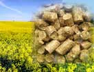

2. Pellets 8mm
3. 6-8 mm DIN+ Quality Pellets
4. We manufacture and sell fuel pellets from straw to European countries
5. Sell wood pellets
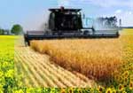
6. Wood pellet manufacturing
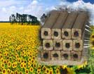
7. Sunflower Husk Pellets
8. Din Plus Wood Pellets
9. Export of sunflower husk pellets to the European market
10. Export of sunflower husk pellets to the European market
New international climate agreement of carbon losses
Thu-09-2016
Data and methods are no longer an obstacle to the inclusion of REDD+ in a new climate agreement, argues Felix Creutzig.
Emissions from tropical deforestation and forest degradation are estimated to account for 7%–14% of the total CO2 emissions from human activities (Harris et al 2012, Achard et al 2014). 'Reduction of Emissions from deforestation and forest degradation (REDD+)' activities can therefore significantly help reduce greenhouse gas (GHG) emissions from forested lands (UNFCCC 2014). To what extent and under what rules REDD+ will be included in the new international climate agreement to be agreed in Paris in December 2015 is a key issue. Establishing robust methodologies for assessing forest activities has been one of the sticking points to include land-based emissions and mitigation in the past. This is particularly so in developing countries where forests are often remote, and there is a lack of inventory data for assessing historical reference levels against which to measure change.
Deriving carbon 'emission factors'
Satellite data is available at fine resolution (30 m) for measuring historical and current land cover change (Hansen et al 2013). More recently remote sensing data has been used to estimate aboveground biomass (AGB). Two widely known pan-tropical AGB datasets (Saatchi et al 2011, Baccini et al 2012) are now extensively used to derive carbon 'emission factors' from local (~100 km2) to continental levels (Langner et al 2014). The Intergovernmental Panel on Climate Change (IPCC) guidelines to estimate GHG emissions and removals from forests, consist of three 'Tier' levels of increasingly sophisticated methods (IPCC 2006). Many developing countries have to rely on 'Tier 1' default emission factors due to missing data or capacities (Bucki et al 2012, Romijn et al 2012). Such new maps can provide more accurate alternative values to the IPCC Tier 1 defaults.
New approach of quantifying carbon losses
Researchers are developing increasingly sophisticated ways of using such satellite data. One example is the recent article by Tyukavina et al (2015) who present a new approach that employs recommended IPCCC good practices and a combination of remote sensing data (De Sy et al 2012) to quantify tropical forest aboveground carbon (AGC) losses from 2000 to 2012. This paper is an important extension of earlier studies applied to the Democratic Republic of Congo and Peru (Tyukavina et al 2013, Pelletier and Goetz 2015). More specifically Tyukavina et al show three technical aspects which allow more accurate estimates of AGC losses:
A sample-based approach had already been applied by Achard et al (2014) to estimate forest area losses, with 4000 units systematically distributed over the tropics. Tyukavina et al produce an unbiased estimate of forest area loss using a stratified random sample of 3000 pixels (~0.1 ha size) distributed in tropical forested regions. Furthermore Tyukavina et al distinguish 'natural forests' (primary and mature secondary forests, and natural woodlands) from 'managed forests' (plantations, agroforestry systems and areas of subsistence agriculture with tree cover rotation). Tyukavina et al confirm that a sample-based approach can provide more accurate, and significantly higher estimate of forest cover losses than a wall-to-wall approach: the higher estimate (due to 85 sample pixels only) is explained by small-scale forest dynamics not depicted in the wall-to-wall tree cover loss map. Getting these small-scale dynamics right can be very important for individual countries in setting accurate reference levels.
Current capabilities of satellite data for relating carbon losses
The biomass data used in Tyukavina et al are derived from the original satellite data used in generating Baccini et al map (2012). The field-calibrated satellite-derived biomass data are employed as a substitute for field inventory data to calculate continent-specific mean strata AGC densities.
Tyukavina et al then quantify AGC losses in a 'stratify and multiply' (stock-difference) approach (Goetz et al 2009) in which areas of forest loss are combined with their associated AGC densities. One of the main originality of this paper is the characterization of tropical forests into seven AGC strata using remotely sensed-derived structural characteristics of tree canopy for year 2000: percent tree canopy cover (Hansen et al 2013), tree height and forest intactness (Potapov et al 2008).
The alarming estimate of natural tropical forest losses at 6.5 Mha yr−1 and emissions of 1303 TgC yr−1 was compared by Tyukavina et al with estimates for same period (2000 s) from more spatially explicit approaches: 813 TgC yr−1 (Harris et al 2012) and 880 TgC yr−1 (Achard et al 2014). It can also be compared with non-satellite estimates such as those from FAO (2015) of around 660 TgC yr−1 (2000–2012 average for tropics). This compares to global emissions from land-use changes of 940 TgC yr−1 (Le Quéré et al (2015)) using FAO data and a bookkeeping model for the time evolution of land-use change emissions (Houghton 2003) and emissions from tropical forest conversion of 980 TgC yr−1 (Federici et al 2015) using FAO data. The use of different definitions and methods can lead to very different estimates of forest area losses: for example Tyukavina et al is defining forests as areas where tree canopy cover is ≥25% when FAO reporting is based on a tree cover threshold of 10% and a land-use definition. Moreover Tyukavina et al account only for gross forest losses when FAO reports net forest loss (including afforestation and forest regrowth) (Keenan et al 2015).
Tyukavina et al (2015) illustrate the current capabilities of satellite data for estimating forest cover losses in the tropics and related carbon losses. A new Earth observation satellite, Sentinel-2A, was launched on 23 June 2015. Sentinel-2A will provide systematic and global coverage of land areas. Its finer spatial resolution (10 m) and higher temporal frequency (10 days revisit time) will allow to quantify tropical deforestation, forest gain and forest degradation more accurately and regularly than with satellite imagery currently available (Miettinen et al 2014). Combining forest area loss and gain data with spatially explicit biomass values and models will enable more accurate (higher) tier methods to be applied to REDD+. Methods using remote sensing data allow now to produce verifiable estimates of Carbon losses from land-use changes in the tropics.
Source: http://ukrfuel.com/news-reporting-carbon-losses-from-tropical-de-83.html
Any copying and distributing withoutactive hyperlink is strictly prohibited!
Views: 1772
 Stobart biomass division is to make a deal

Biomass Related News
- Analysis of the Ukrainian market of sunflower husk pellets
- RPD and XOOM Energy Team Companies declare about its alliance
- Briquettes used in district heating in Floby, Sweden
- New world record for solar cell efficiency
- Burning wood biomass: an opportunity or a problem?
- Ikea’s new foray to sell solar panels
- Changing of Neutral rating for Drax Group
- Firefighters is training how to deal with solar panels
- Floating solar panels generating green energy
- Leidos Inc. is selling its Plainfield biomass power plant
|
© Ukrainian Biofuel Suppliers 2008-2024 |